
Malaysia - Basement Mapping
A case study from the Bell Geospace Malaysian Multiclient data in the Sabah region.
Sabah is characterised by basement lithologies of variable composition surrounded by basins on its northwest, north, east and south margins. Basement interaction with the development of these basins is profound through the interplay of thrust/reverse fault motion and compressional wrench fault motion yielding pronounced closed structures suitable for hydrocarbon entrapment.
Air-FTG® data across Sabah offers fresh insight into mapping these lucrative basement structures. Basement in North West Sabah as mapped with Air-FTG® is shown below in Figure 1. The positive anomalies (reds) track the known reverse fault trend and blue colours map the lateral extent of sediment filled synform.
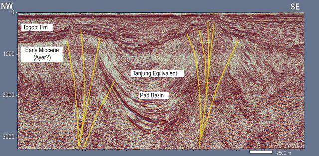
The FTG datasets map key structures across Sabah facilitating confidence when mapping geology from between seismic lines. Flower structures in the Sandakan Basin are cored by mobile shale and express themselves in the form of anticlinal positive structures. FTG detects these as localised positive Tzz responses.
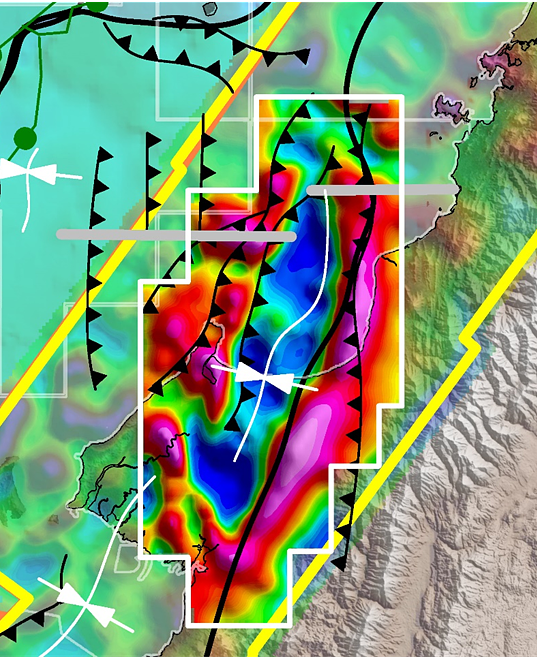
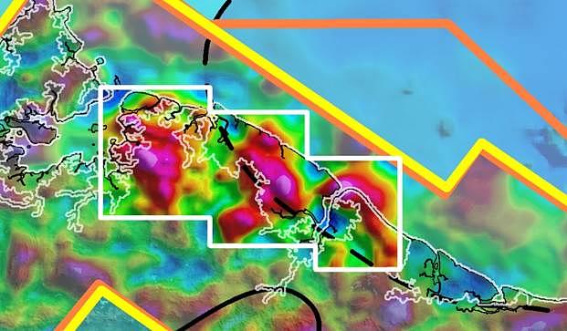
Figure. 2 shows a seismic example of such structures from the offshore part of the basin. Figure. 3 shows the FTG response of their density effect from onshore the Dent peninsula.
Intuitive usage of Air-FTG® data with both current and newly acquired seismic will facilitate direct 3D mapping of not only top basement complexity, but track key thrust and reverse faults from line to line across the In Board and Out Board basins area. In addition, direct mapping of key inversion and other closed structures across the Sandakan Basin will expedite exploration efforts in this prospective basin.