
FTG GTZ
The GTz® airborne gravimeter (added to the Bell Geospace portfolio in 2020) provides exploration projects with Gz accuracy to <1 mGal across multiple scenarios.
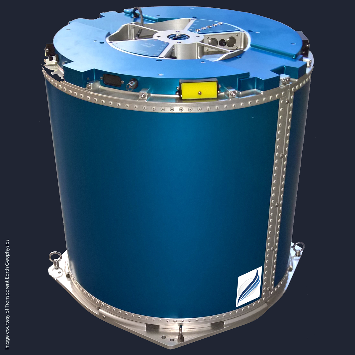
Airborne FTG is exceptionally well suited for geological mapping and delineation. However, when FTG technology is required to image density contrasts from deep geology generating much longer wavelengths, such as in deeper water environments, it benefits from the addition of a good gravimeter.
In 2020 Bell Geospace entered into an exclusive arrangement with Transparent Earth Geophysics to install the GTz® on our aircraft alongside the existing FTG technology. The install was successfully completed in July 2021.
With the addition of the new GTz® gravimeter, Bell Geospace data acquisition and processing is now set to provide the best possible results in any environment with any depth to target with FTG GTZ. From onshore, through transition zones and into deep water operations.
For more information on the technology behind the GTz® gravimeter or its creator, Transparent Earth Geophysics, please visit their website.
New integrated gravimetry and gradiometry service
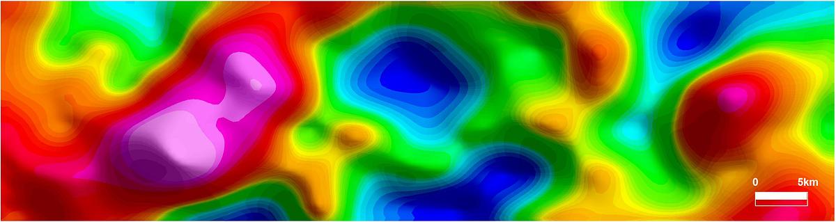
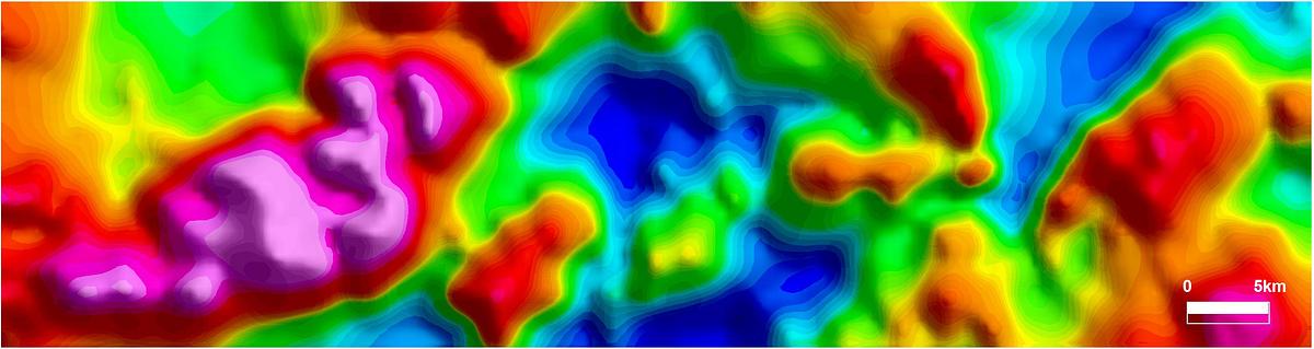
The images shows gravity and gravity gradiometry data from Arnhem Land, NT, Australia. They collected independently in 2003 (GT-1A) and 2006 (Bell Geospace FTG). The top image shows the GT-1A free air anomaly data reprocessed to produce 4km resolution, and the bottom image shows the combined GT1A & FTG Gravity, or Tze, data produced by Bell Geospace. The latter displays significantly more high frequency information content.