
Structural Mapping - Mindoro Island, Philippines
Air-FTG® data was acquired for Pitkin Petroleum over South West Mindoro Island in 2012 to identify and map the foreland basin's structural fabric.

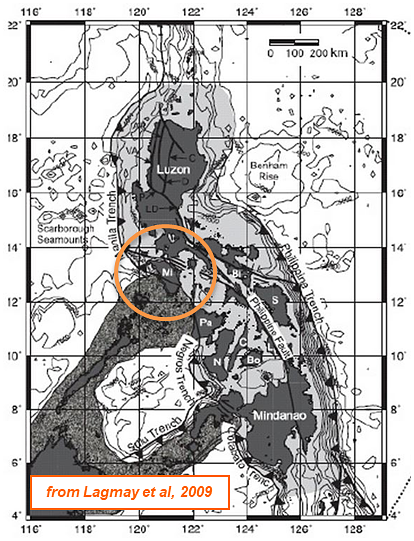
Mindoro Island is located at the junction between the Eurasian, Pacific and Indo-Australian plates resulting in complex thrust and fold structures accommodated by north-northeast to north oriented wrench faulting. High terrain on the eastern part of the island delineates key structural information, but detecting occurrences beneath the lower elevation foreland basin areas to the west has proved challenging.
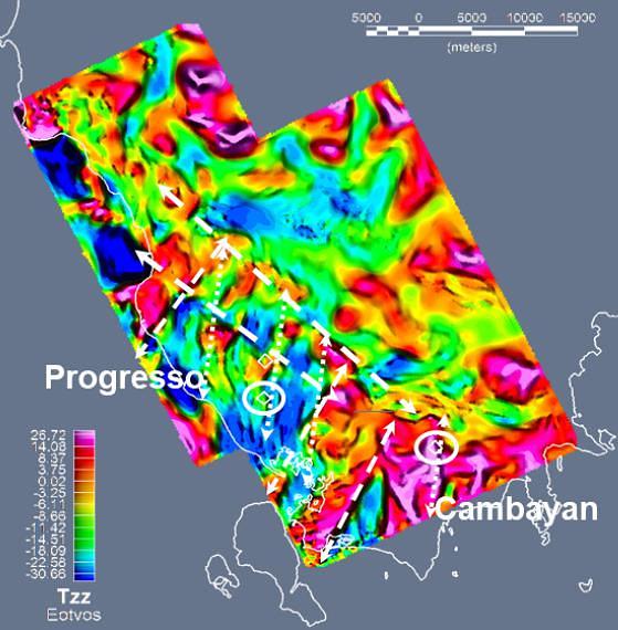
Figure 1 shows the Tzz component data acquired in 2012. The data clearly identifies:
- Northwest oriented thrust fronts.
- North-northeast trending transfer faults underpinning the Progresso and Cambayan discoveries.
- Northeast oriented normal faults.
2D seismic data coverage shows varied quality across South West Mindoro. One of the better lines is shown in Figure 2. The northwest-southeast line transgresses Progresso and encounters a thickening sedimentary section that is fault bounded to the southeast by a normal fault. The FTG response curves yield a positive Tzz and Txz component anomaly facilitating mapping of the structure across the survey area, particularly for the north-northeast trending transfer faults.
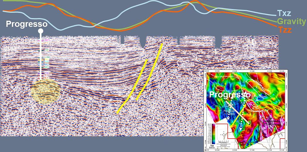
The Progresso structure is defined by a subtle seismic response. In contrast, the same structure yields a clear positive anomalous response on the Txz component that is mapped as a north-northeast trending lineament. This strategic use of FTG presents a clear advantage when exploring foreland basins to not only map the principal structural trends but also locate potential closed structures hosting hydrocarbons.