Full Tensor Gradiometry Imaging of A Blind Geothermal Play In The Crescent Valley Geothermal Field of Northern Nevada, USA
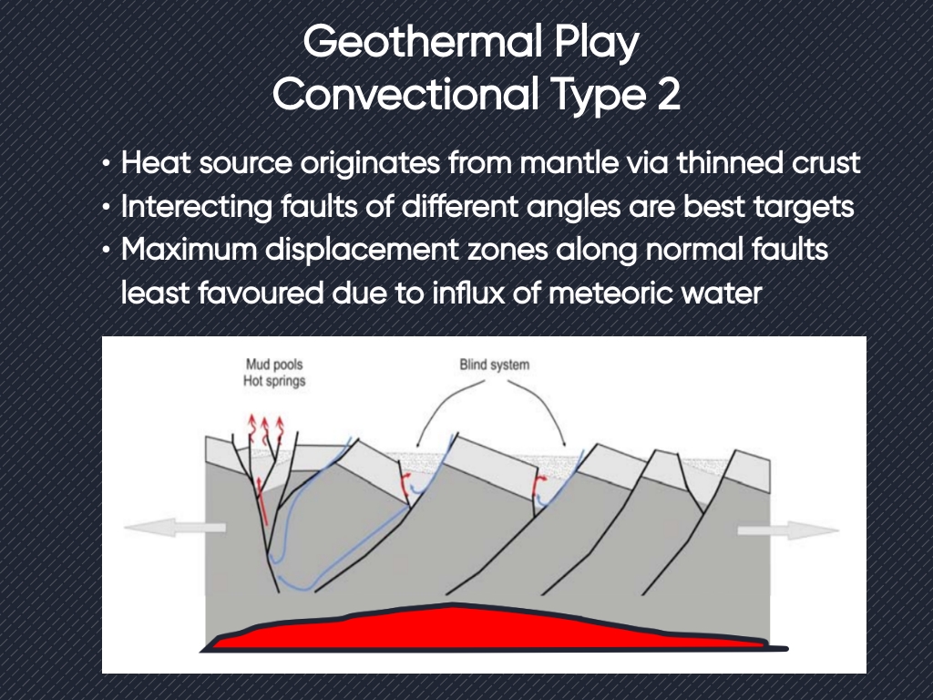
Faults play a critical role in fluid flow and conduction of heat in geothermal systems by facilitating or stifling fluid flow. Identification of fault geometry is key to determining prospectivity. Faults buried under recent alluvial cover are challenging to identify without benefit of seismic data and full geometric interpretation of such faults often require the acquisition of expensive 3D seismic data. Gravity data is a cost-effective solution to identify geometry of faults, but the time required to collect data may be lengthy or land access may be restricted. The alternative is to use Airborne Full Tensor Gradiometry (FTG) as a fast effective way to map the structural framework.
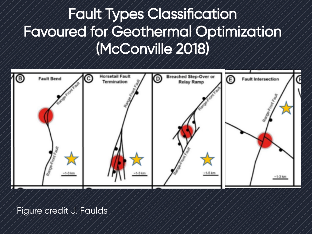
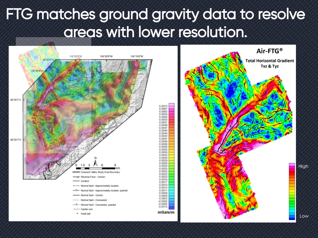
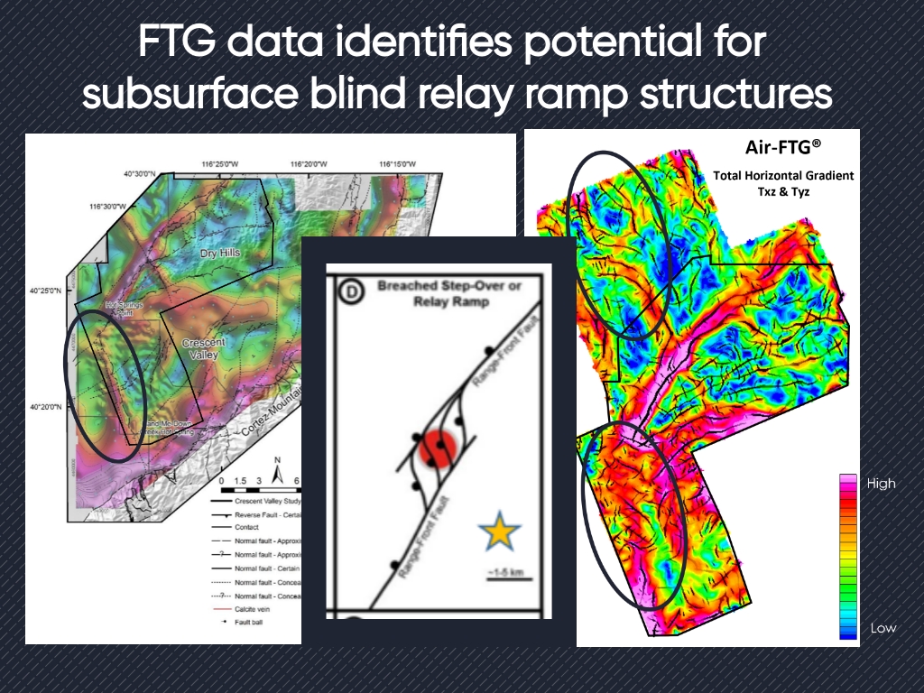
FTG data acquired over the Crescent Valley geothermal field in Nevada reveals previously unmapped faults and identifies their relationship to the regional structural framework. Intersections of faults are additionally identified through lineament extraction methodologies, which in turn contribute to the identification of favourable geothermal prospects.
A buried relay ramp is identified through the interpretation of the FTG data that was not previously evaluated for geothermal prospectivity.
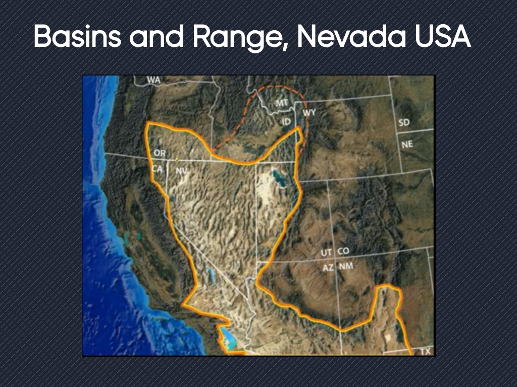
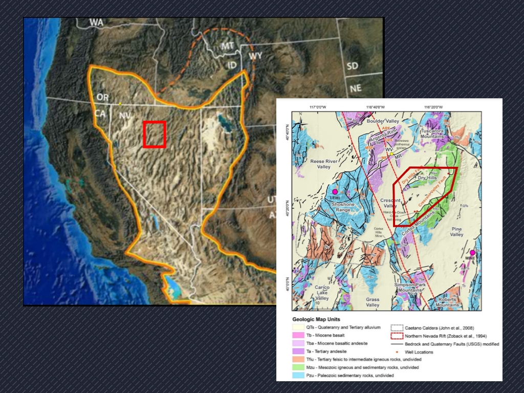
The Crescent Valley geothermal field is a convection type geothermal play that is located along the eastern edge of the Northern Nevada Rift within the Basin and Range province. Several hot springs are located along the eastern edge of the rift, with the Beowawe Hot Springs, Dry Hills Hot Springs and Hand-Me-Down Creek Hot Springs being the most proximal to the study area.
The assessment of faults is key to identifying favourable geothermal plays within an extensional basin convectional geothermal play. Faults act as a conduit for heat flow and may also contribute to localized permeability when compared to the local stress regime. Faults with surface expression are readily mapped by both remote and field methods. Faults covered by sedimentary fill are challenging to map and often require expensive data acquisition to yield results. 3D seismic methods are often out of budget for geothermal exploration, leaving possible missed resources due to the limited coverage of 2D methods.
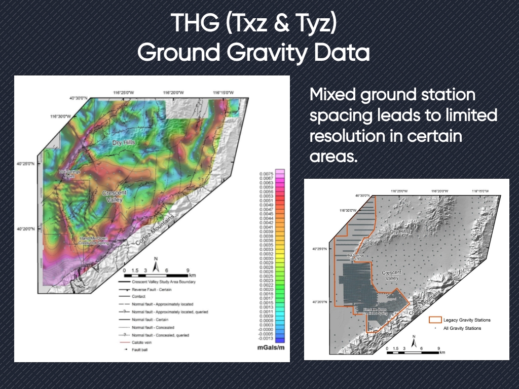
Full Tensor Gradiometry was acquired over the Crescent Valley geothermal field with a nominal spacing of 200 meters in 2005 for the purpose of identifying hydrothermal gold prospects. Additional constraining data were published in 2018, providing a structural fault framework comparable to the results of FTG acquisition to investigate possible missed structures.
FTG data are sensitive to shallow density contrast that is associated with the shallow faults expected to host geothermal prospects in the Crescent Valley geothermal field. Data resolution is comparable to the highest resolution ground data acquired over the area of interest, with the FTG data providing an improved image of fault terminations. FTG data is acquired with regular spacing that gives the interpreter an advantage when applying enhancements to reveal linear trends associated with faults in the subsurface. The data, which is critical to structural framework interpretation, is acquired and processed rapidly and offers coverage which images areas where ground crews have limited access